In 2018—2019, Zoï collaborated with the World Bank to raise awareness of national hydrometeorological services and their information products. Supported by the Global Facility for Disaster Risk Reduction and Recovery (GFDRR), this assignment aimed to inform the public and various weather-sensitive sectors about the range of available information products and how and where to use them.
The scope of work included country visits and workshops with national hydrometeorological services, and joint work on the visual atlas “Weather, Climate, and Water in Central Asia: A Guide to Hydrometeorological Services in the Region”. Each country visit followed a common program, which included discussions with the hydromet management and technical units, peer-to-peer exchanges on information communication, and meetings with information users.
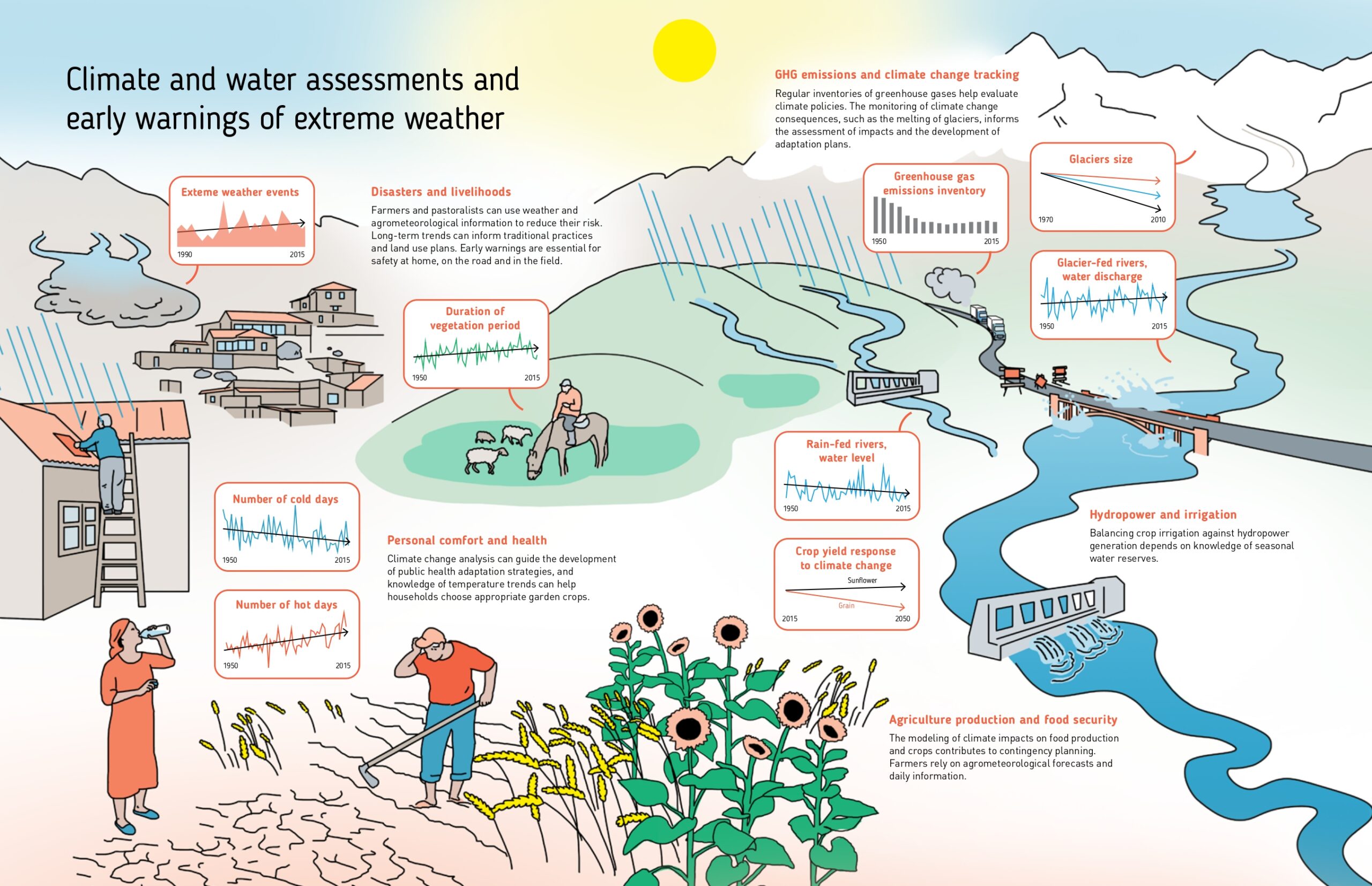
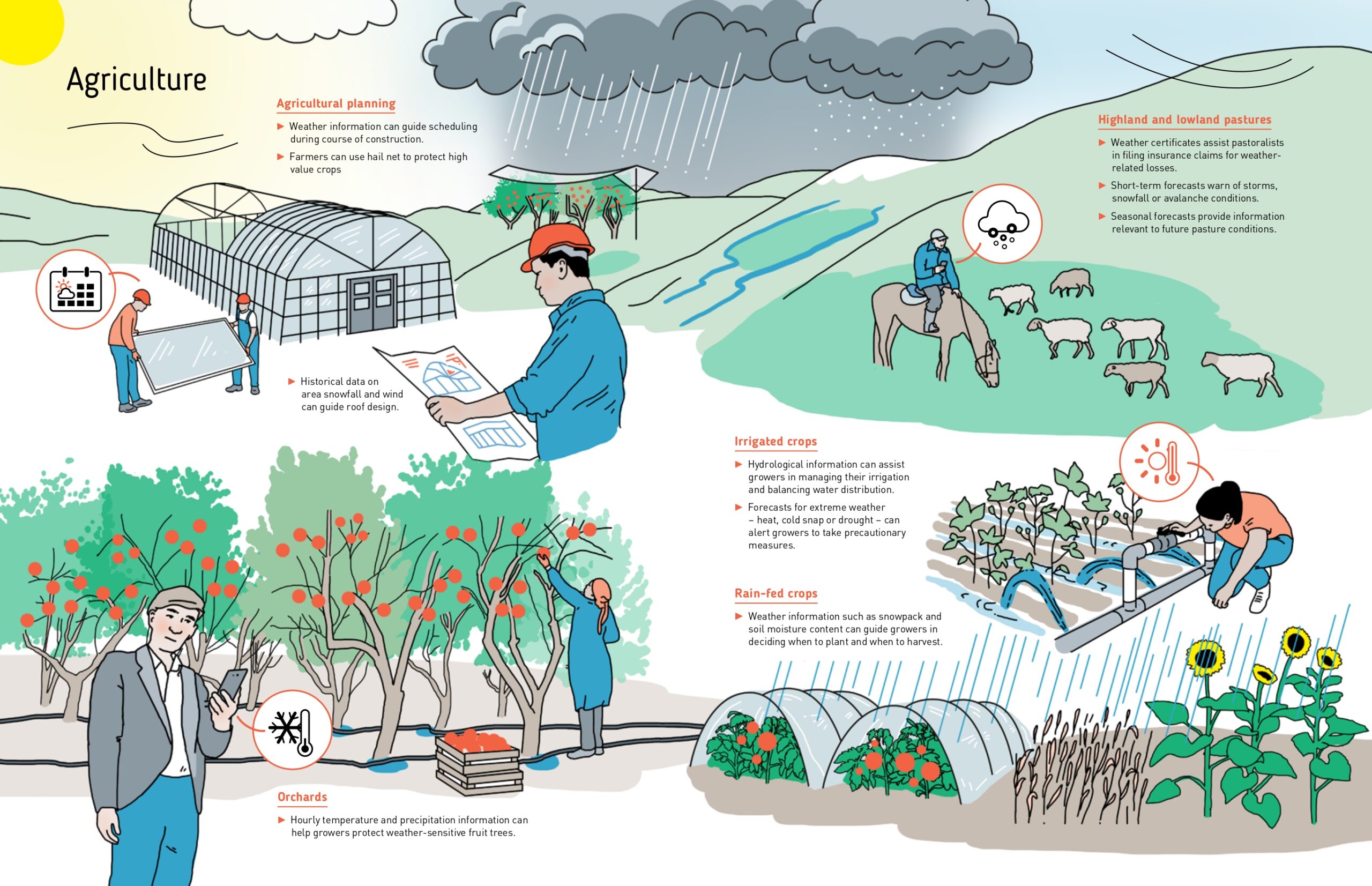
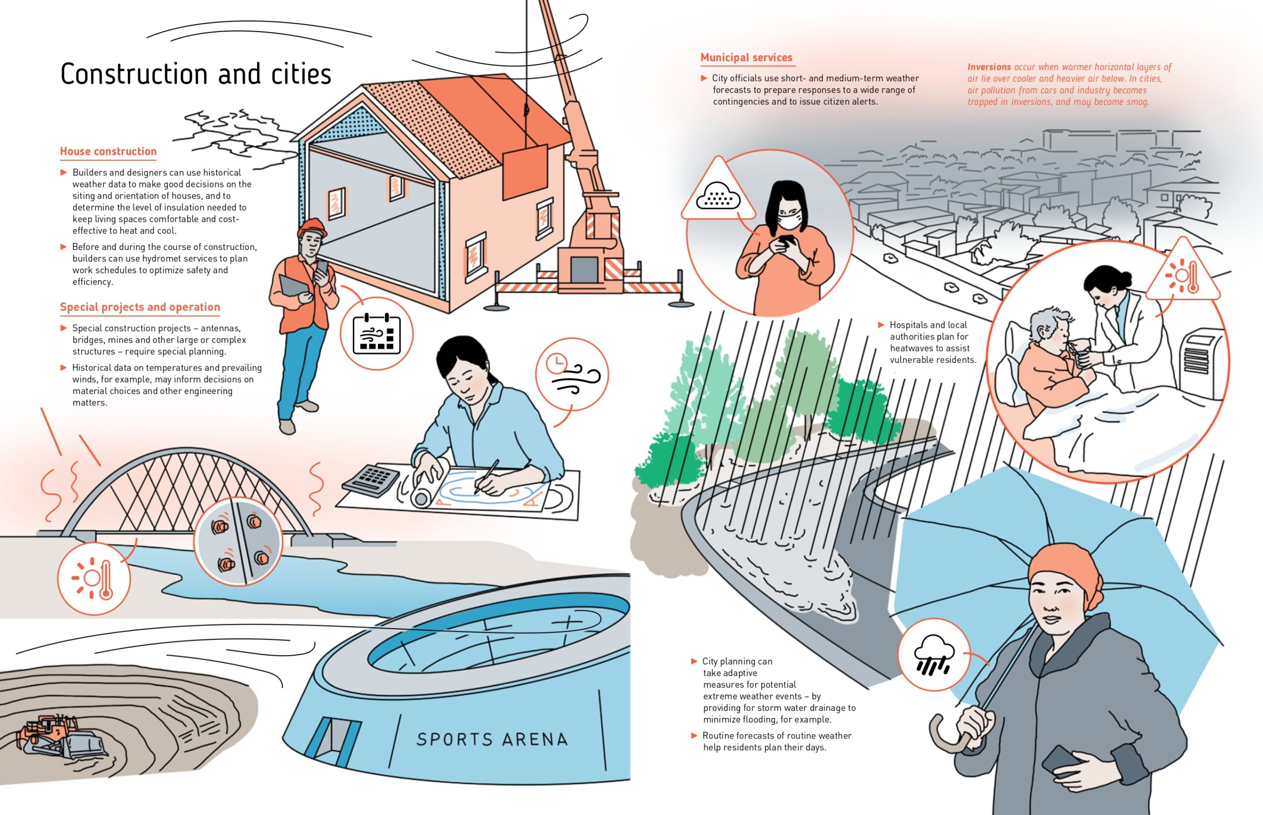
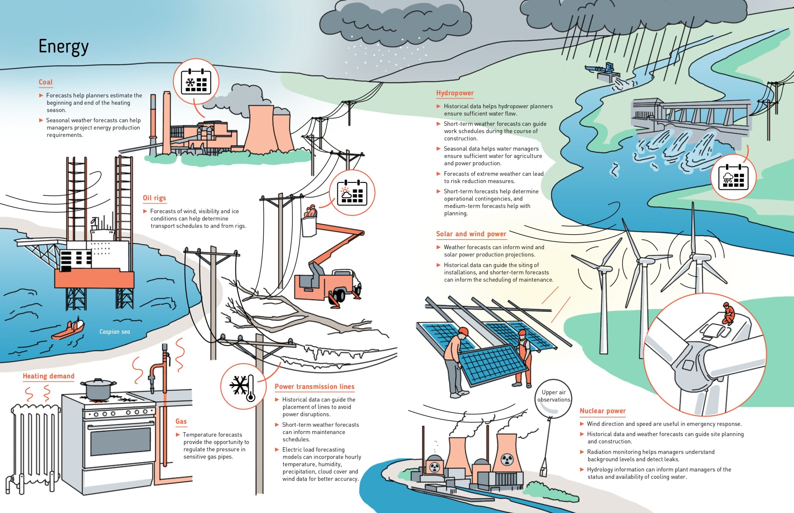
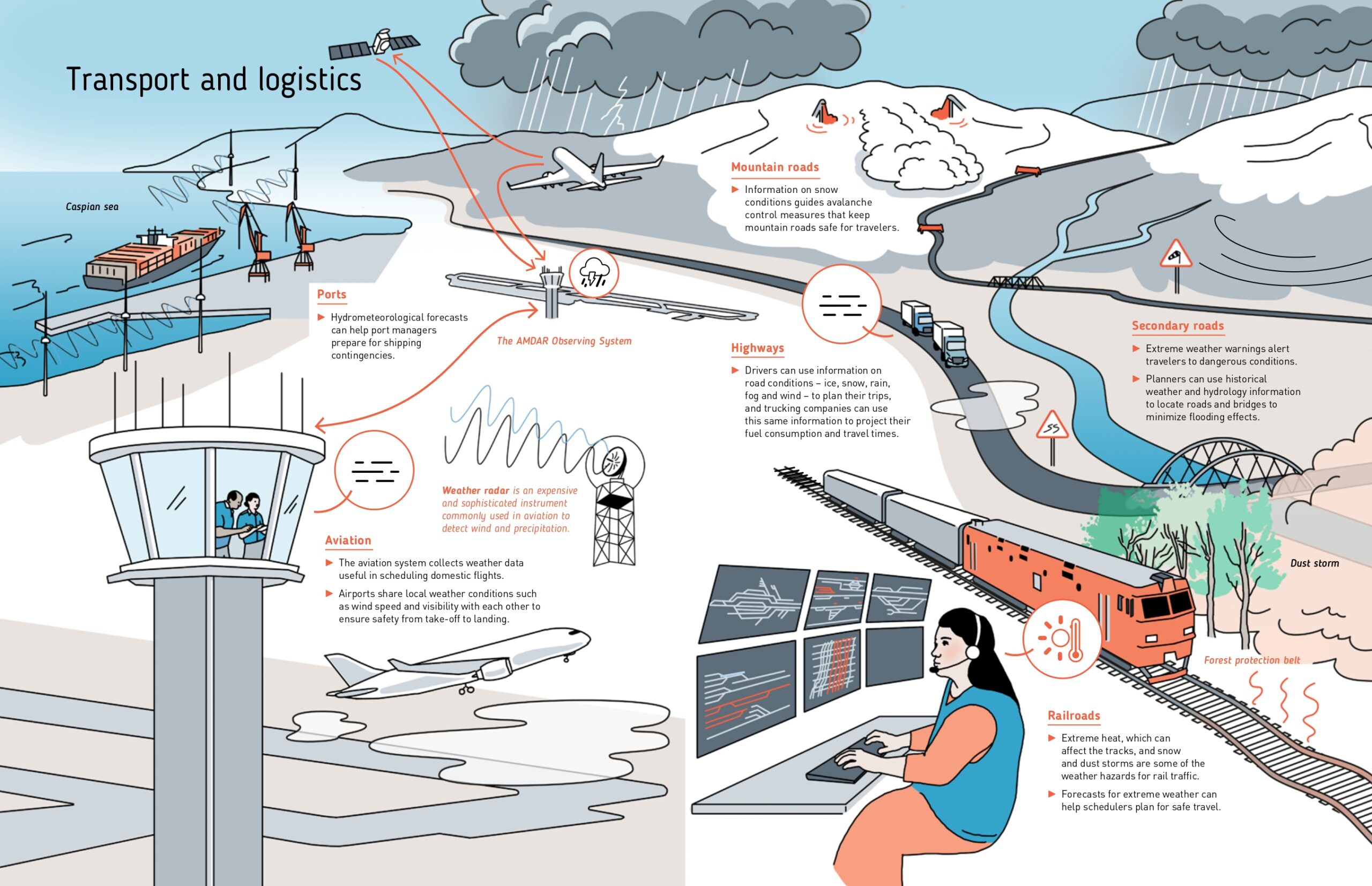
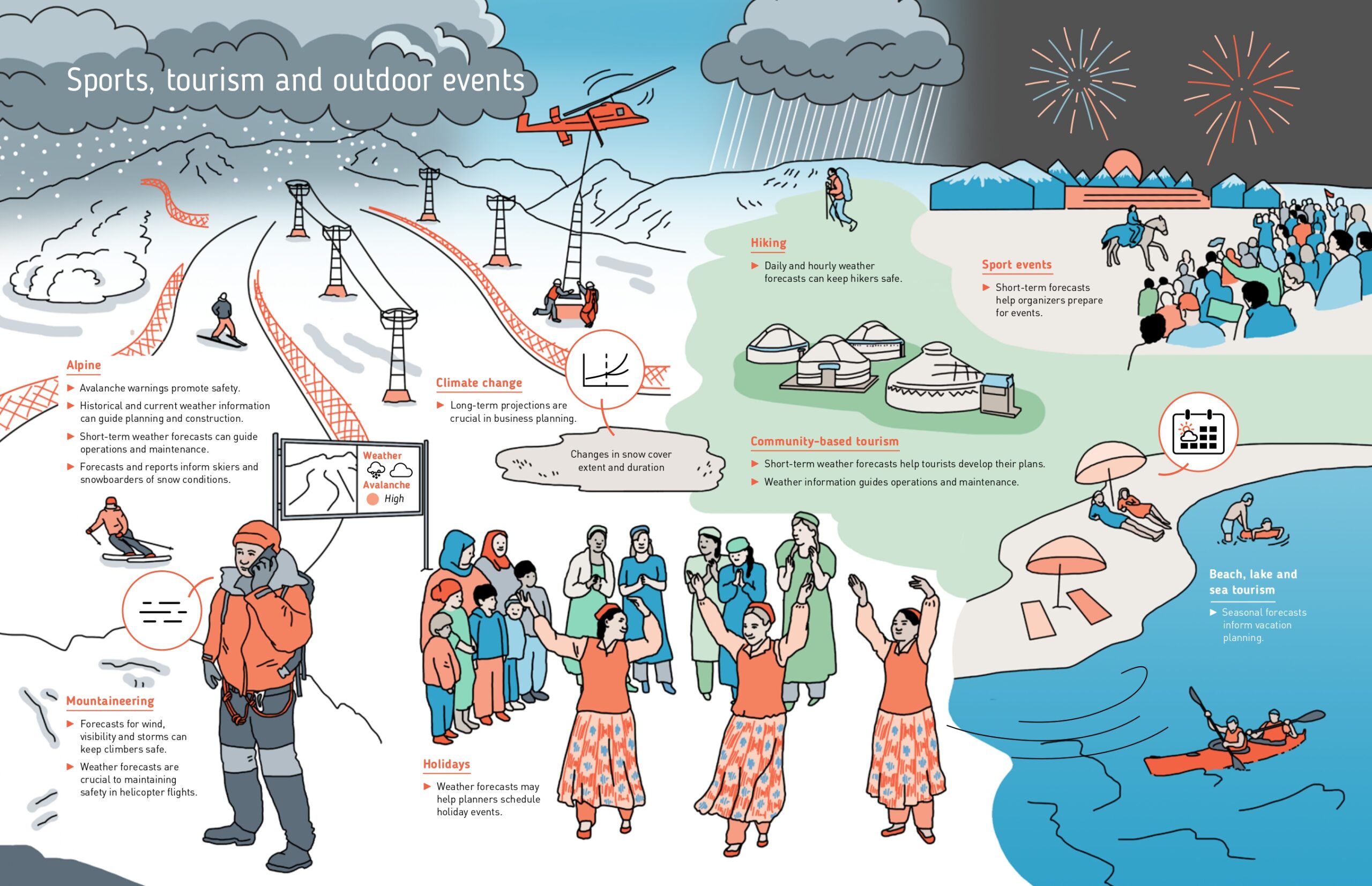
A wide range of users need climate and weather information, including farmers, energy and transport sectors, tourism and mining operators, sport events, and the general public. They all have different requirements, expectations, and applications of information. Satisfying these demands can be challenging, particularly in mountain regions with complex weather and hydrology systems and sparse observation networks. Mountains act as regional water towers. Data on water formation and forecasts are crucial for planning in downstream nations. Thus, the regional picture is important.
Users of weather, water and climate information
Users of weather, water and climate information
Users of weather, water and climate information
Users of weather, water and climate information
Users of weather, water and climate information
Users of weather, water and climate information
For this reason, and due to the rapid evolution of technology, the World Bank and other partners supported major modernization efforts in Central Asia. These efforts resulted in higher-quality, more accessible, and more comprehensive information potentially available to users, opening new opportunities for existing and new clients.
The atlas covers regional and national scales and includes themed maps and visuals that explain how hydrometeorological services operate, their observation network, the data and products they produce, and how these can be used. Accessible and timely data is essential for disaster risk reduction and adaptation measures and allows people and institutions to anticipate extreme events.
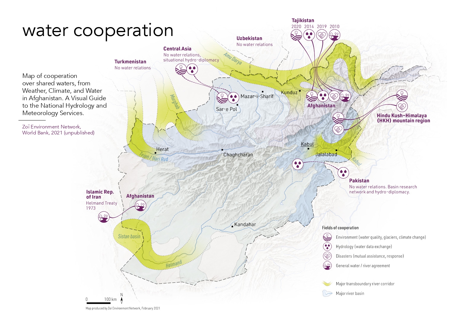
Following the work in Central Asia, a hydrometeorological atlas for Afghanistan was developed jointly with Afghanistan’s national partners, including stakeholder meetings in Kabul. However, this atlas could not be released due to the change in leadership and political regime after the US withdrawal in August 2021.